XST-PhotoNet-FVC Vegetation Cover Meter
offeringssummarize
XST-PhotoNet-FVC Vegetation Cover Meter is based on the automatic extraction algorithm of vegetation under natural lighting conditions (MSI-Kmeans), through the training of a large amount of data and the number of features, to realize the accurate classification of the vegetation in the image with the background (soil or sky), non-vegetation, and the shadow of the vegetation in a variety of lighting conditions, and to calculate the degree of vegetation cover (the degree of cover obtained from the upward observation of forests). , often also referred to as the degree of depression).
Users can adjust the working mode of the Vegetation Cover Camera according to the growing conditions of the vegetation and the purpose of observation, for example, the camera can be set up vertically upwards in the forest, and set up vertically downwards in the low plants. The vegetation coverage camera records time series images at the same time, which can be used as climate data for climate research, and can record weather conditions and lens cleaning conditions to assist in judging the quality of the data.
system software
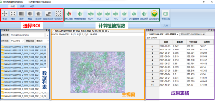
In addition to the automatic output of coverage values, the system also provides SmartViewer, a PC-based weather image data processing software developed for XST-PhotoNet series products, which can batch process, filter and interpolate the original time series image data of the product images, freely select the ROI region of interest, recalculate the FVC vegetation coverage, and support a variety of data Filtering algorithms.
Technical Parameters
transducersnodal | Sensing Type | CMOScamera shot (in a movie etc)CriteriaRGBTrue color image output |
pixel size | 500W | |
protection class | IP66 | |
field of view | 60° | |
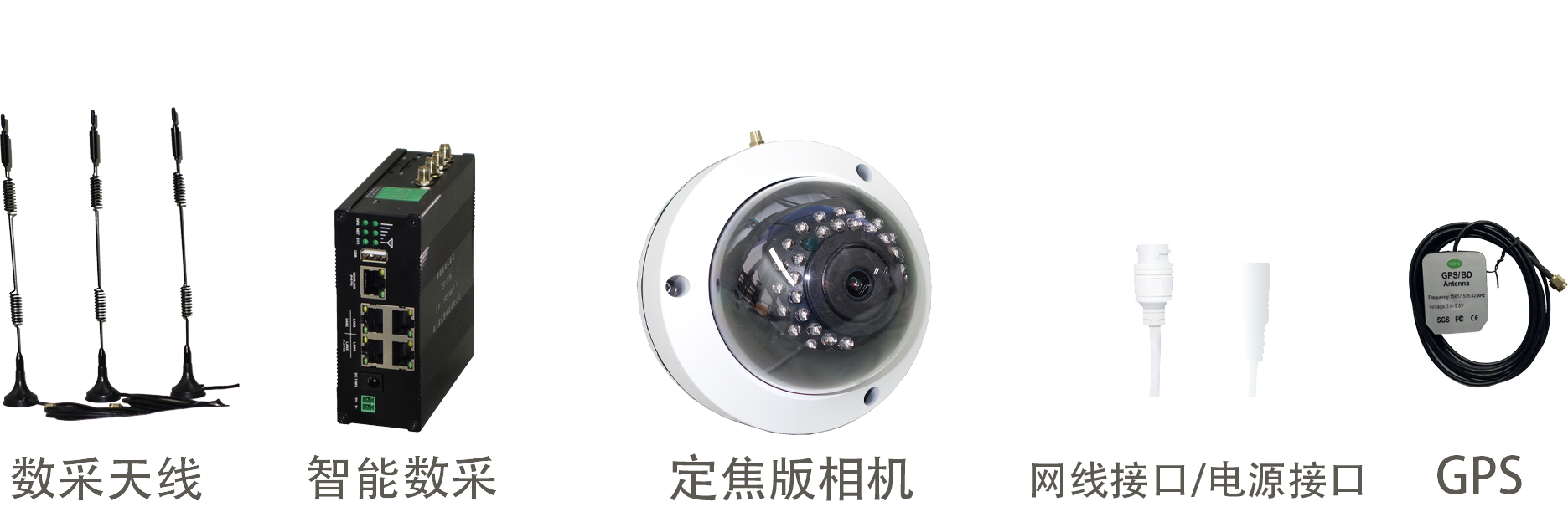
Intelligent Digital Mining | this localitynewsletter | Local support for high powerWIFIRealize kilometer-scale wireless connectivity of nodes |
node connection | Wired for connection4Sensor nodes; no limit to the number of nodes in the wireless mode | |
Data Acquisition | Sunrise and sunset method of data acquisition: built-in algorithms to acquire images at sunrise and sunset, ensuring that the natural light of the sky is relatively uniform dawn and twilight, and acquiring data more accurately. | |
Built-in algorithm to automatically obtain the vegetation coverage, support local saving; also support remote transmission, disconnection and continuous transmission | ||
operating mode | Stationary all-weather fully automatic | |
working environment | Working temperature:-40 °C~50 °C (c) Operating humidity:0%~100% RH | |