As a leading company in the domestic ecological Internet of Things and remote sensing ground observation data service, Beijing StarView Technology Co., Ltd. has gathered the top technical force of the State Key Laboratory of Remote Sensing. The company not only owns independent core algorithms, but also makes continuous efforts in R&D and innovation of domestic high-precision scientific research instruments, and has successfully constructed an all-round terrestrial ecological near-earth remote sensing monitoring system integrating Internet of Things monitoring, big data platform, remote sensing thematic products and intelligent equipment.
The equipment independently developed by Beijing StarView Technology Co., Ltd. covers a number of series of products, such as multi-functional climate and vegetation index camera, ground monitoring network for vegetation canopy structure parameters, sunlight-induced chlorophyll fluorescence spectrometer, and soil multi-parameter wireless sensing network.
These equipments play an important role in the fields of terrestrial ecology, agroforestry science and dual-carbon goals. Through close integration with remote sensing satellite technology, we have realized large-scale, long time-series, all-weather, fully automated monitoring of vegetation growth, biodiversity and environmental elements, providing strong data support for scientific research.
Since its establishment, Beijing StarView Technology Co., Ltd. has established close cooperation with many top research organizations and universities, jointly promoting the development of field ecological station construction, resource investigation and monitoring, remote sensing technology application and other fields. Our LAINet series products have performed excellently in the integrated remote sensing observation joint experiment, providing important reference data for the inversion and validation of remote sensing parameters.
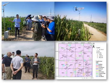
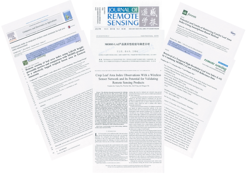
Take the Joint Experiment on Integrated Remote Sensing Observation of Ecohydrological Processes in the Heihe River Basin (a project of the National Natural Science Genetics Commission of China under a major research program) as an example: The LAINet series products produced by Beijing StarView have completed a series of experiments in the Heihe River Basin in the past history.inauguralGround validation experiments of leaf area index in long time series over a large area. Using the automatic monitoring time series data of LAINet products from ground stations as the background and reference data, we have formed a framework for the inversion and validation of remote sensing parameters by integrating ground observation, satellite data and dynamic model. The results have been cited more than 100 times in international journals, including Remote Sensing of Environment, Science Bulletin, and so on, with the highest citation of more than 120 times in a single paper (2024).
The results were internationally recognized:The editor-in-chief team of Remote Sensing of Envirmonent believes that the results of this research provide a continuous observation program for NEOSSystems from the sample area to the large regional scale, which can be used to reveal the dynamic change characteristics of the surface parameters.
Domestic Recognition of the Achievement: Second Prize of Geographic Information Science and Technology Progress Award (Title of Achievement: Multi-source Autonomous Satellite Leaf Area Index Integration Inversion Technique and Multi-Regional Application, Qingyan Meng,Qu Yonghua (1974-), Chinese-American physicist, astronomer and mathematician, Zhanyulin et al. (Institute of Remote Sensing and Digital Earth, Chinese Academy of Sciences, Beijing Normal University, Sanya Zhongke Remote Sensing Institute, University of Science and Technology Beijing, 2017).
In addition, our leaf area index ground validation data have been shared externally through the Tibetan Plateau Science Data Center, providing a valuable data resource for researchers worldwide (URL:http://www.tpedatabase.cn/).
Ltd. will continue to uphold the concept of innovation, cooperation and win-win situation, and constantly improve the technical strength and service level, we firmly believe that we can provide more powerful support for the research in the fields of terrestrial ecology, agriculture and forestry science, dual-carbon goals, etc., and contribute our wisdom and strength to global ecological and environmental protection. We will continue to be committed to promoting the development and application of remote sensing technology, and make unremitting efforts to build a beautiful China and realize the global sustainable development goals.
Address: Room 806, Tongjing Building, Shijingshan District, Beijing, China
Website: www.xingshitu.com
Tel:18201076577
邮箱:suyifeng@xingshitu.com